Montreal Shatters May Temperature Record With A 98°F High On Wednesday
by Dennis Mersereau
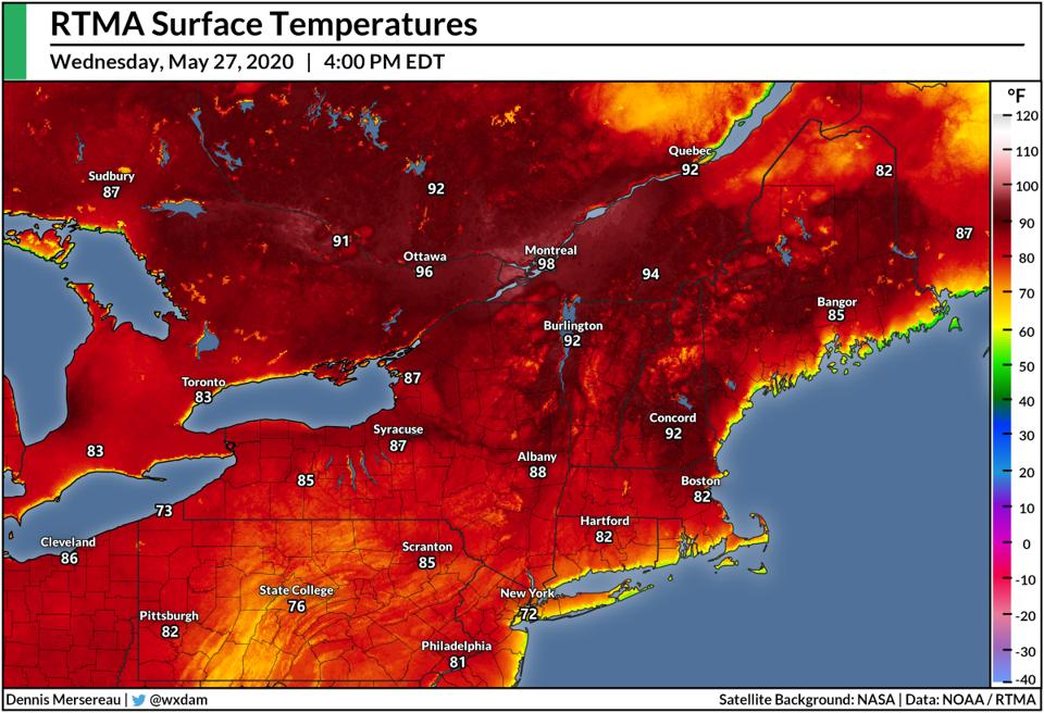
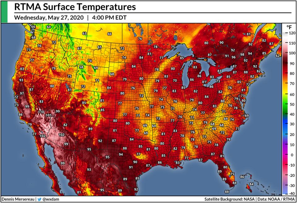
A short but intense heatwave swept over southeastern Canada and the American Northeast this week, bringing record heat and severe thunderstorms to the region. Temperatures climbed into the upper 90s on Wednesday as far north as the Montreal metro area, shattering monthly records and coming in as one of the region’s warmest afternoons in recent memory.
An upper-level ridge moving over southeastern Canada allowed temperatures to soar into the 90s across areas that are accustomed to comfortable weather through the latter half of spring.
The temperature reached a sweltering 98°F at Montreal-Trudeau International Airport on Wednesday afternoon, ranking among the hottest readings ever recorded there. For reference, the average high in Montreal on May 27 is about 70°F.
Such a high reading so early in the year may sound like the work of a faulty sensor, but other stations along the St. Lawrence and Ottawa Rivers corroborated the intense late-spring heat. Montreal-Mirabel Airport and Ottawa Airport had both reached 95°F by 3:00 PM on Wednesday.
If the 98°F reading at Montreal-Trudeau stands, it would become the station’s highest temperature on record for the month of May and come in as one of the hottest temperatures ever recorded at the station, where records stretch back to the early 1940s. The highest temperature on record there was a 100°F reading on August 1, 1975.

Temperatures also climbed uncomfortably high in northern New England for the second day this week. Burlington, Vermont, topped out at 94°F before nearby thunderstorms cooled things off. That balmy reading, if verified, would also break the city’s previous high temperature record of 93°F for the month of May.
While heat alone is usually bearable in small doses, this was not a dry heat. Dew point readings—a more accurate reading of moisture levels than relative humidity—reached the low 60s well into Quebec, which would qualify as muggy anywhere let alone in this region at the end of May. The combination of high temperatures and muggy air made this heatwave especially brutal for a population not used to this kind of sultriness, and where air conditioning isn’t nearly as widespread as it is south of the border.
The warm and muggy airmass also allowed bouts of severe thunderstorms to develop on Wednesday. Severe thunderstorm watches and warnings stretched from upstate New York to the southeastern shores of James Bay in Quebec. Isolated severe thunderstorms produced high winds, large hail, and flooding downpours across the region.
Temperatures will cool down significantly by the end of the week as the ridge moves out over the Atlantic Ocean and a trough digs south to replace it. Cooler, drier conditions will prevail across southeastern Canada and much of the Northeast and Mid-Atlantic by this weekend, with morning lows on Monday possibly dipping into the 40s as far south as the mountains of North Carolina.