A Tropical Disturbance Soaked Miami With Six Inches Of Rain In Two Hours
by Dennis Mersereau
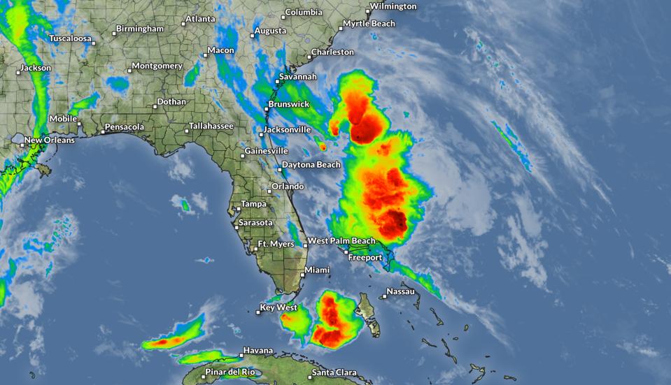
Widespread heavy rainfall associated with a tropical disturbance will soak portions of the southeastern United States this week, potentially leading to flooding issues across areas that have seen plenty of rain in recent days. The storm already has a history of major flooding after training thunderstorms dropped more than half a foot of rain on the Miami metro area in just a couple of hours.

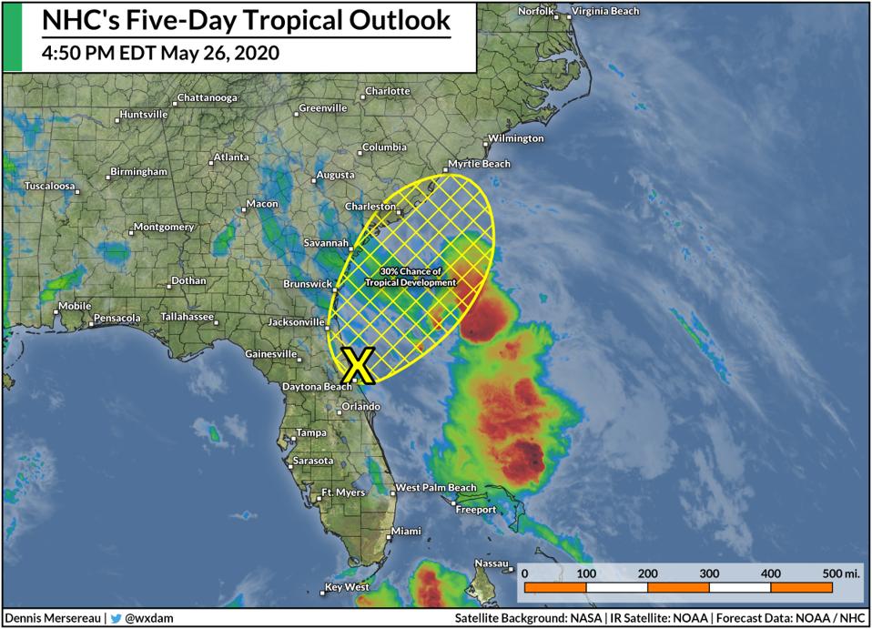
The National Hurricane Center gives the tropical disturbance off Florida’s coast a 30 percent chance of developing into a tropical depression or a tropical storm by Wednesday afternoon. There’s a limited window for development before the center of the system comes ashore on Wednesday. However, the system’s classification is largely technical and it will have the same impacts regardless of development.

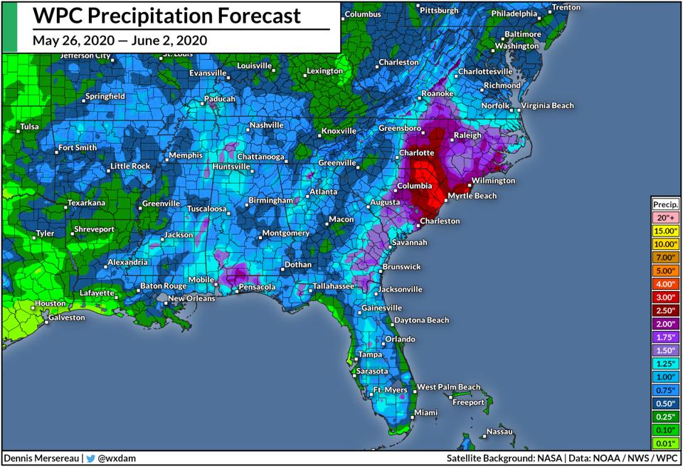
Heavy rain is the greatest threat with this disturbance. The Weather Prediction Center expects several inches of rain to fall across the coastal Carolinas over the next couple of days. The agency’s rainfall forecast (pictured above) covers the period between May 26 and June 2.
The rainfall already generated by this system is proof enough that a tropical system doesn’t need a name or special advisories in order to cause significant issues. Thunderstorms on the southern end of the disturbance produced tremendous rainfall rates in southeastern Florida on Tuesday afternoon. Miami International Airport recorded 7.07 inches of rain in just six hours on Tuesday evening, with the bulk of the rain falling in a two-hour window. The excessive rainfall led to widespread flash flooding across the region, even in areas that don’t typically experience flooding.
In addition to the heavy rainfall, there’s a low risk for severe thunderstorms in eastern South Carolina and southeastern North Carolina on Wednesday afternoon. Some of the thunderstorms triggered by the disturbance could drag strong winds down to the surface, leading to isolated instances of wind damage. It won’t take much wind to bring down trees and power lines given that the soil is saturated from all the rain of late. There’s also the potential for a couple of tornadoes in the affected areas if a strong thunderstorm can tap into the wind shear available on Wednesday.
If this system manages to develop into a depression or storm, it would be the second preseason system we’ve seen this year. Tropical Storm Arthur formed off southeast coast earlier in the month. The storm came within 20 miles of making landfall on Cape Hatteras, North Carolina, on May 18, 2020, producing heavy rain and gusty winds across the state’s Outer Banks. The Atlantic hurricane season officially begins on June 1.