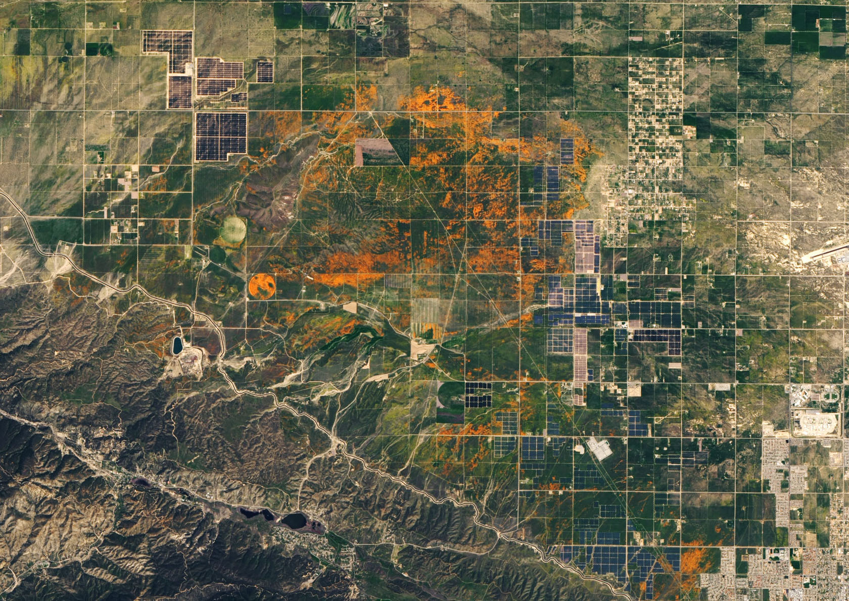
NASA EO
Here’s NOAA’s outlook for US summer weather—and hurricane season
The world saw the 2nd warmest April on record, but frost hit some US crops.
by Scott K. JohnsonOn Friday, NOAA released its latest seasonal weather outlook for the US, which followed an updated hurricane season outlook. As always, the seasonal outlook starts with a look back at the previous month.
April 2020 was the 2nd warmest April on record globally, but a southward meander of the jet stream over Canada and the eastern US made this region of North America the exception. For the contiguous US, April was slightly below the average going back to 1895. Precipitation was similarly just below average, but a few states including Colorado and Nebraska had an extremely dry April, while the Virginias and Georgia were extremely wet.
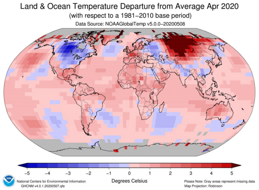
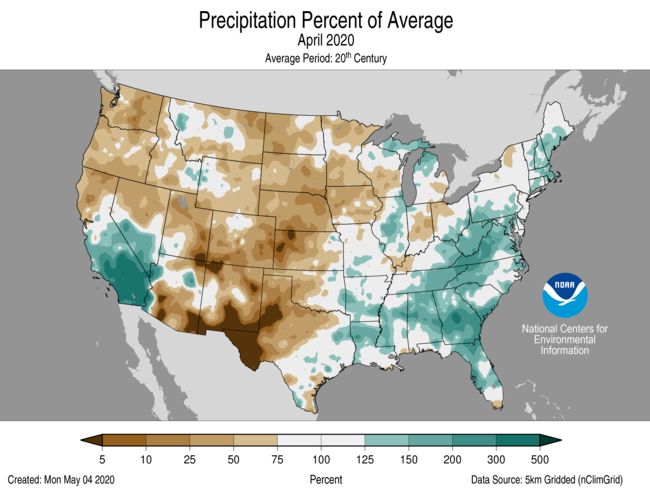
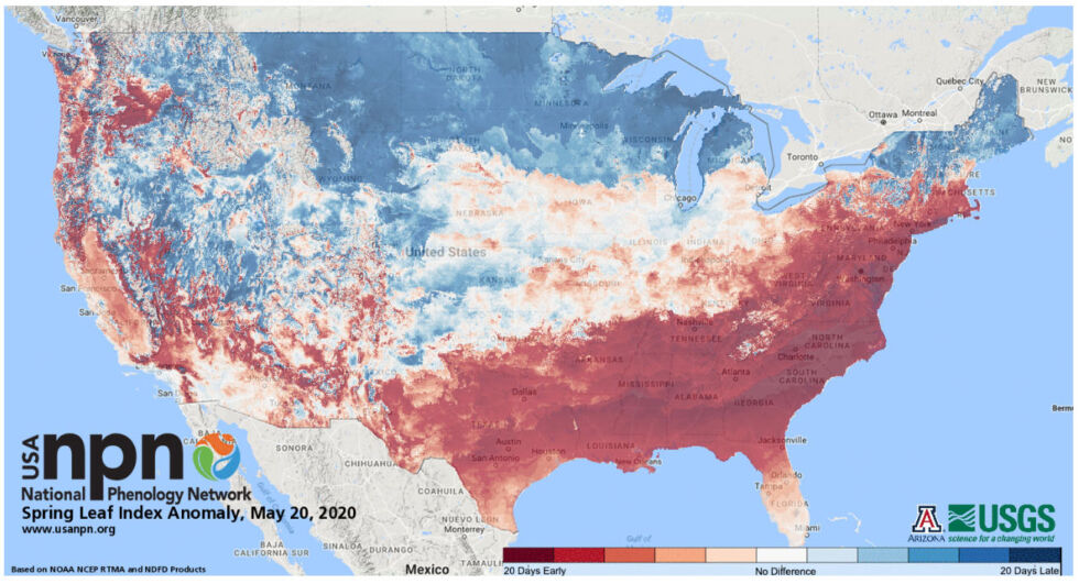
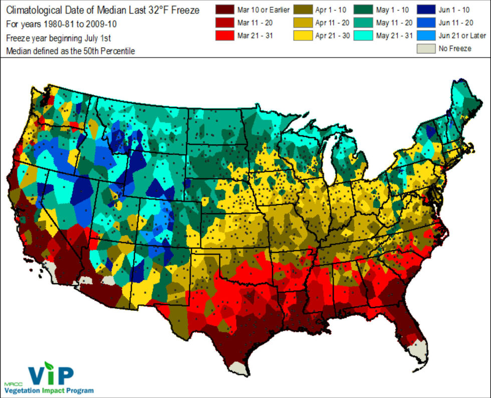
If you live around the Midwest or Plains states, you won’t be surprised to hear that recent weeks have not been particularly warm. That’s because mid-April saw a hard freeze come through, with another freeze in the second week of May. While the April freeze wasn’t really late compared to the long-term averages, it followed a warm spring that caused vegetation to pop up early in many places—only to be bitten by a frost.
As a result, some crops saw significant damage. Winter wheat that had sprouted was hit in the Central Plains. Elsewhere, some vegetables that had been planted were lost, and fruit trees were particularly vulnerable. For example, NOAA’s briefing pointed to peach orchards in Colorado that reported losses of up to 90 percent.
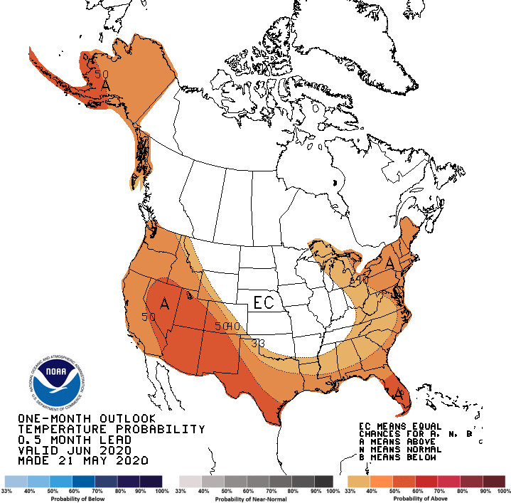
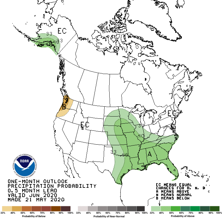
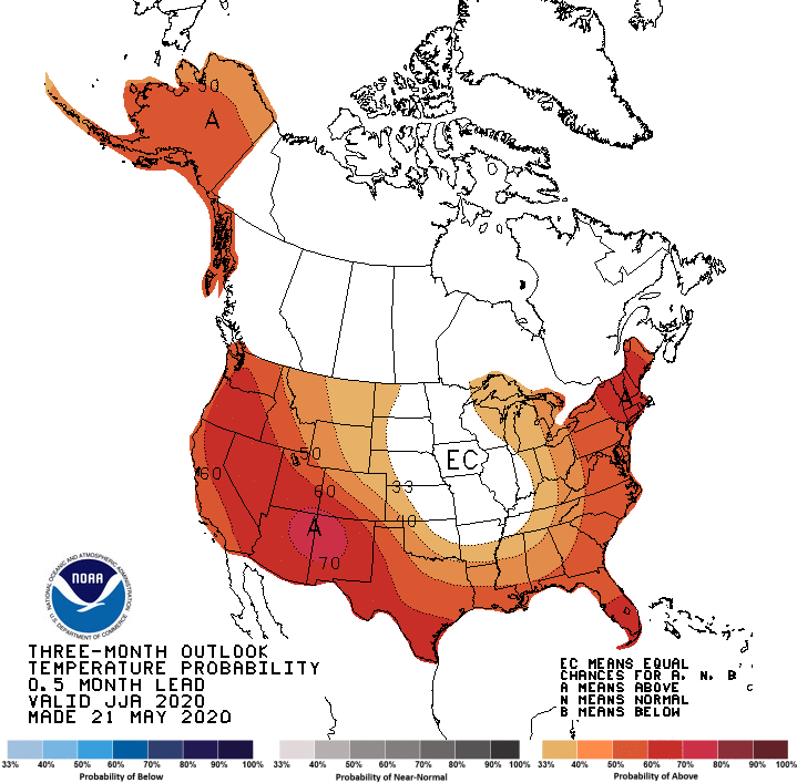
The outlook through August—based on things like sea surface temperature patterns in the Pacific, long-term patterns and trends, and some long-range modeling—shows widespread warm temperatures but an east-west divide in precipitation.
The El Niño Southern Oscillation in the Pacific remains in a neutral state, and so is not loading the dice for anything particularly unusual. The model forecast is starting to lean towards mild La Niña conditions this fall, though, which would bring an end to an extended run stuck in neutral.
Warmer-than-average temperatures are expected to dominated for most of the US, including Alaska. The Midwest and Northern Plains have equal chances to come in above or below average, though. As for precipitation, most of the eastern US sees solid odds for above-average rainfall, while the northern tier of western states is likely to be below-average.
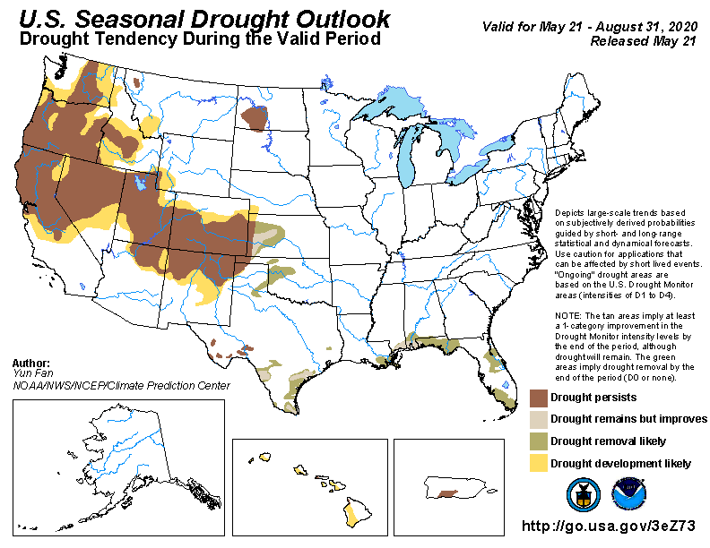
It’s no surprise, then, that existing droughts from Colorado across to Northern California and up to Washington are expected to persist and expand. Hawaii and Puerto Rico are also seeing drought conditions that aren’t expected to change. Some areas around the Gulf Coast may well see an end to their droughts, though.
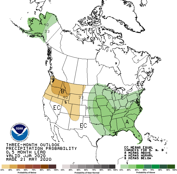
Some of the precipitation outlook in the East ties into the hurricane season. NOAA is still estimating a 60 percent chance of above-average hurricane activity in the Atlantic. That would equate to roughly 13-19 named storms (above the average of 12), 6-10 that reach hurricane strength, and 3-6 that reach Category 3 or higher.
While hurricane season forecasts are more uncertain than the seasonal weather outlooks—and there’s no telling whether major storms would make landfall or spin out their lives in the open ocean—the logic behind them is pretty simple. El Niño conditions in the Pacific tend to suppress hurricane activity in the Atlantic through a few atmospheric dominoes. We’re looking at neutral conditions that may drift towards La Niña, which will have the opposite effect.
Additionally, sea surface temperatures are running hot in the Gulf of Mexico and the Caribbean, and wind patterns across the Atlantic are lining up with past active hurricane seasons.
It goes quite without saying that a weather disaster during a pandemic would further stress an emergency response system that is already stretched to the limit. It would be a good year to put a little extra effort into preparation if you live in an at-risk area.