STORM DENNIS: It's going to get seriously wet and windy this weekend
by Gavan Becton
A Status Yellow Wind and rainfall warning is currently in place for all of Ireland as Storm Dennis (as named by the UK Met Office), strengthens in the North Atlantic
While staying to the northwest of Ireland Storm Dennis will produce some wet and windy weather over Ireland this weekend.
Warm air being pushed up along the US east coast meeting very cold air over Eastern Canada is the driving force for this powerful jet, with winds up to 225knots (~416kph) at its core, currently aiding the rapid development of Storm Dennis.
Dennis will develop rapidly today, to put this into perspective, rapid cyclogenesis is defined as a drop in pressure of greater than 24hpa in 24hours, this storm is forecast to drop by around 70hpa in 24hours as it rapidly tracks north towards Iceland and with a forecast central pressure in the low 9-teens it will rival the lowest ever pressure recorded in the north Atlantic of 913hpa off the coast of Scotland Jan 11th 1993. Thankfully the core of Storm Dennis stays well to our northwest as it rapidly strengthens before pirouetting (the Fujiwhara effect) around Fridays low and comes back to visit us on Sunday as it slowly weakens.

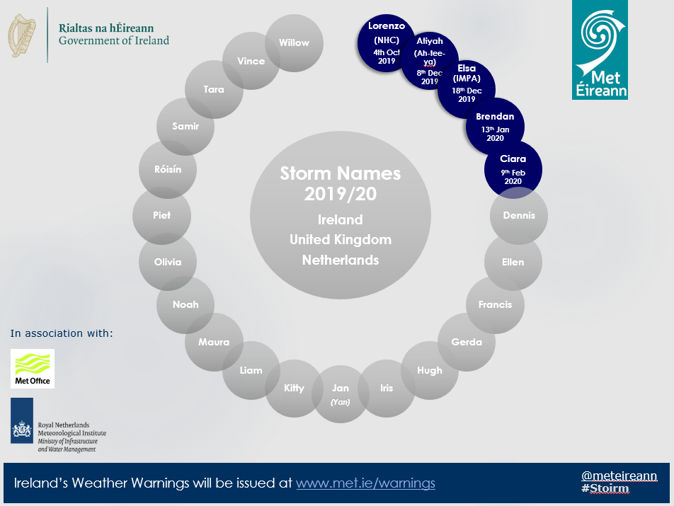
The order of storn names as decided by the Irish, UK and Dutch Met Offices.

Saturday - The first round of wet and windy weather will reach the Atlantic coast on Saturday morning spreading countrywide during the morning easing later and Status Yellow wind and rain warnings are in operation.
Sunday - The core of storm Dennis (actually a hybrid of Fridays Low and Storm Dennis) will gradually fill and weaken as it tracks south-eastward towards Ireland bringing squally showers with a risk of thunder. A widespread StatusYellow wind warning has issued and possibly Orange level winds locally (especially in the vicinity of squally showers along Atlantic coasts) can be expected.
Monday - Winds will gradually ease through Monday, but not dissimilar to this past Monday showery conditions can be expected with wintry conditions possible.

Status Yellow - Wind warning for Ireland
Very squally Southerly winds veering Southwesterly with mean speeds 50 to 65 km/hr gusts to around 100 km/hr, strongest on exposed coasts and hills. Winds moderating from the Northwest later.
Valid: 03:00 Saturday 15/02/2020 to 20:00 Saturday 15/02/2020
Issued: 11:00 Friday 14/02/2020
Status: Yellow
Rainfall warning for Ireland
Status Yellow - Rainfall warning for Ireland
Spells of heavy, locally thundery rain, on Saturday will lead to some flooding.