Weatherman Issues Update on Cyclone Belna
by Eddy MwanzaKenya’s Meteorological Department issued a statement on Monday, December 9, dismissing claims that cyclone Belna would hit Kenya.
In a statement sent to newsrooms, the weatherman admitted that despite the cyclone influencing the current extreme weather patterns, it was impossible for it to make landfall in the Kenyan Coast, according to the laws of physics.
"Tropical cyclones do not form within 5 degrees north and 5 degrees south of the Equator. Therefore, cyclone Belna cannot hit Kenya but will strongly impact the weather conditions," read a section of the statement.
The meteorological department added that Kenyans should brace themselves for the adverse effects of the cyclone through heavy rainfall in the Southern parts of the country.
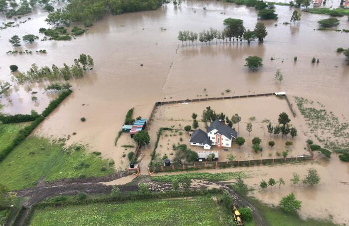
"Belna is currently influencing the weather over Kenya indirectly, by creating favorable conditions for heavy rainfall in the Southern parts of Kenya," the document further disclosed.
However, the government was quick to reiterate the fact that the news being spread around social media regarding an impeding cyclone was actually false.
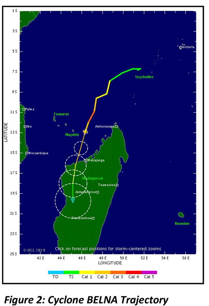
"Contrary to information being spread on social media, the cyclone Belna is NOT headed for the Kenyan Coast. It is moving southwards towards north-western Madagascar."
Going on to provide a satellite image confirming that the cyclone was indeed headed towards the island nation.
According to the United States’ National Oceanic and Atmospheric Administration, a tropical cyclone is a rotating, organised system of clouds and thunderstorms that originates over tropical or subtropical waters and has closed, low-level circulation.
Cyclones occur in areas where there is low pressure. For a cyclone to form, a large and still warm ocean area with a temperature above 26.5°C is required, where a body of warm air forms just above the ocean’s surface.
As this air warms, it expands, becomes lighter and rises, leading to a sustained low-pressure area. Low altitude winds blow in to replace this air that has risen. This air is warmed and also rises.
The rising air contains large amounts of water that has evaporated from the ocean’s surface. As it rises, it cools, condensing to form huge clouds. These clouds eventually become very thick and heavy.
Condensation then releases the latent heat energy stored in the water vapour, providing the cyclone with more power. This forms a self-sustaining heat cycle.
The force created by the earth’s rotation on a tilted axis, known as the Coriolis effect, causes rising currents of air to spiral around the centre of the tropical cyclone. These currents blow counterclockwise in the Northern Hemisphere and clockwise in the Southern Hemisphere.
Because the earth’s Coriolis force is zero at the equator, air tends to flow straight into centres, so any areas of low pressure will dissipate before a self-sustaining heat cycle can form.
However, it's important to note that 17 tropical cyclones have occurred within 3°N and 3°S of the equator, and 3 of them have happened in the Indian Ocean. The one that came closest to Kenya is Cyclone Agni which occurred in late 2004 in the North Indian Ocean, affecting the coast of Somalia.
Notably as well is the fact that global warming has had a sizeable effect on the magnitude of recent cyclones across the world.
According to the Natural Resources Defense Council of the United States, over the past 50-plus years, the earth’s oceans have absorbed more than 90% of the extra heat generated by global warming, becoming warmer as a result, which in turn has acted as more fuel for devastating hurricanes.
Category 1 cyclones have sustained winds of at least 119 km/h. The highest classification in the scale, Category 5, consists of storms with sustained winds over 251 km/h.
